WYCO Historical Museum Sponsors Victory Highway Traveling Exhibit
Published on December 07, 2023

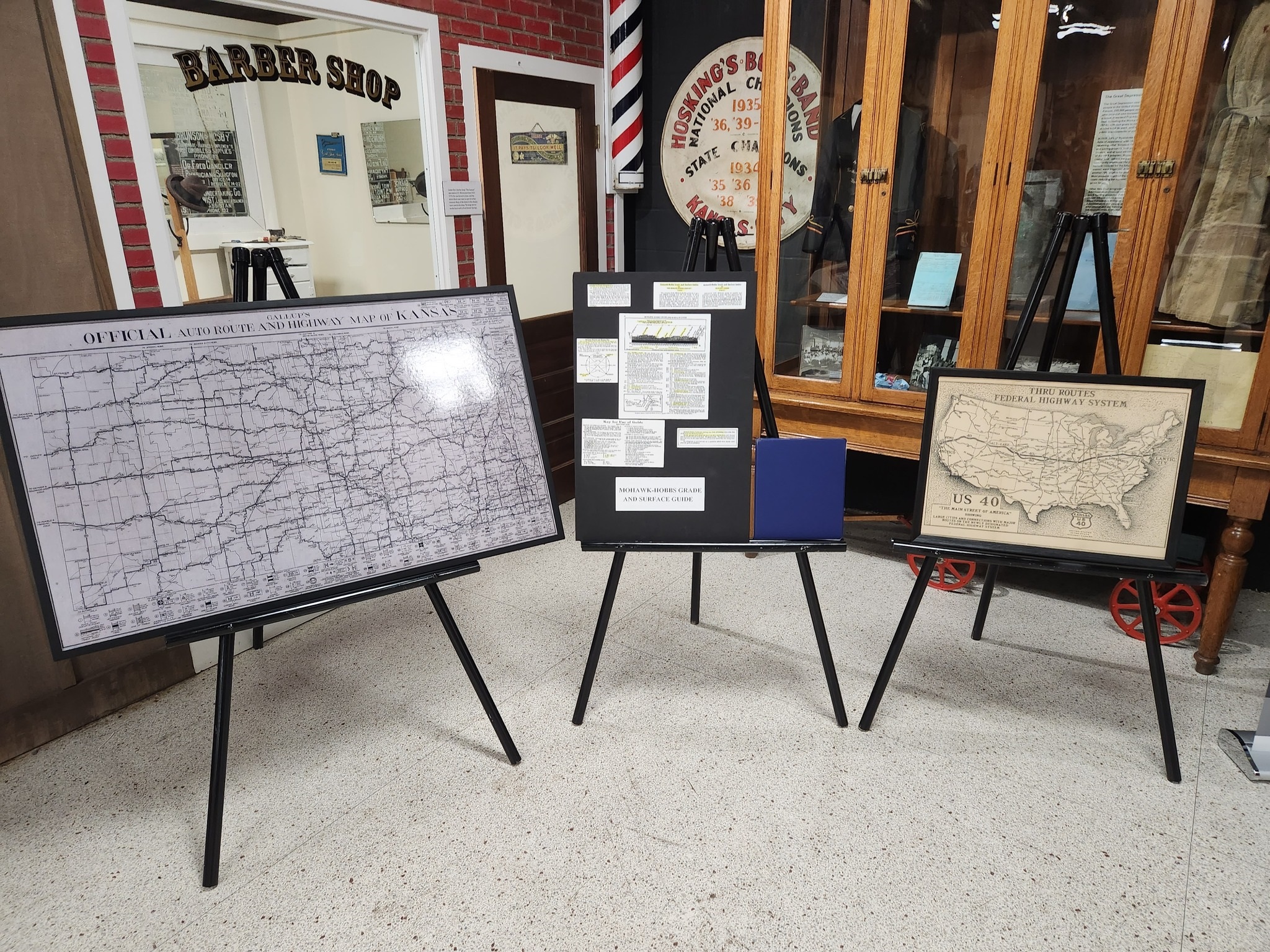
A traveling exhibit, "Hitting the Road: 100 Years on the Victory Highway," is now on display through the end of January 2024 at the Wyandotte County Historical Museum, 631 N. 126th St., Bonner Springs, in celebration of the 100th anniversary of the Victory Highway, one of the first U.S. national highways.
The Museum hours for the free exhibit are Monday-Saturday, 9 a.m. to 4 p.m.
The exhibit tells the story of one stretch of this early paved roadway and the history of road development that proceeded the Victory Highway (now U.S. Highway 24/40). The exhibit also highlights the road’s origins as a war memorial, its state-of-the-art paving and shares stories of the road’s impact on the lives of communities it passed through.
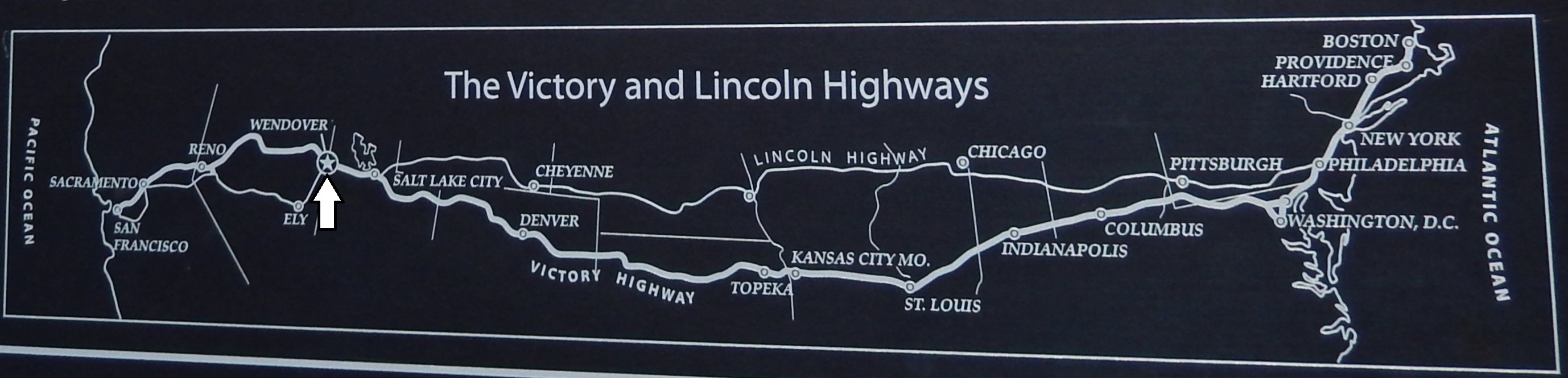
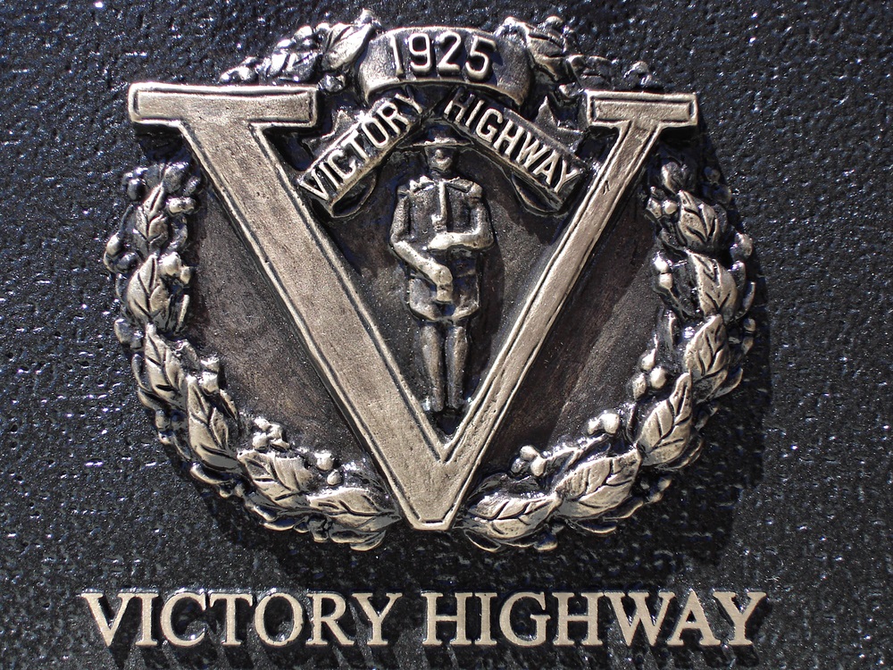
The Victory Highway was dedicated to U.S. veterans returning from the Great War and memorializing the fallen as a matter of national importance. In 1919, the Victory Highway Association, an association of private citizens, headquartered in Topeka, Kan., proposed a modern paved roadway stretching from coast to coast (New York City to San Francisco, Calif.) that would also serve as a war memorial to unite the grieving nation.
Once the coast-to-coast plan for the Victory Highway was devised, the State of Kansas launched into action. Kansas, notorious for its poor road conditions, modernized their proposed Victory Highway section quickly. By September of 1923, workers finished a 60-mile concrete-paved stretch of road between Topeka and Kansas City, Kansas, passing through several communities, including Lawrence, Tonganoxie and Victory Junction in rural Wyandotte County, the first section of the Victory Highway paved in the nation.
On October 3, 1923, a large picnic celebration was held in Tonganoxie. As many as 10,000 people attended the grand opening of the completed section of the Victory Highway. The paved road included a spur from Victory Junction in Wyandotte County to Leavenworth, also known as the Fort-to-Fort Highway.
A series of Victory Eagle sculptures were planned to mark the entire Victory Highway route, although only a few were actually built and placed. Three of the six remaining Victory Eagles are located in Lawrence, Topeka and Wamego.
In Wyandotte County, Victory Junction was one of the largest roadside attractions on the Victory Highway. In 1921, WYCO locals, Harry and Althea Jons, opened Liberty BBQ nearby. A few years later, a full-scale model of a Dutch windmill was constructed, housing a service station, restaurant and motel. The center of the roadway was the original site of a World War I Doughboy memorial statue erected in 1929. Today, this intersection is now Parallel Parkway and North 139th Street (Kansas 7 Highway) in western Wyandotte County. The doughboy statue was moved to the grounds of the Leavenworth County Courthouse in 1941.
By 1925, the Victory Highway transcontinental route offered a panorama of the mid-section of the country that epitomized the western expansion of the nation from colonial days to the present time. For 3,205 miles, this great motorway followed the same course, or one closely parallel, as that of the earliest settlers of the Ohio, Mississippi, and Missouri valleys, crossing 14 states in all. Less than 14 percent or 788 miles of the highway, was unimproved.
In 1938, federal highway managers introduced a uniform road numbering system that ended use of the Victory Highway name. Today, Kansas travelers know Victory Highway as U.S. 24/40, a mostly two-lane blacktop road that runs parallel to I-70 through the entire state.
Victory Drive, which runs between North 38th Street and Parallel Parkway in KCK, is also a remnant of the original Victory Highway.
This exhibit is made possible by the Tonganoxie Community Historical Society, Watkins Museum of History of Lawrence, The Wyandotte County Historical Museum, the Kansas State Historical Society and the Gallup Map & Art Company of Kansas City, Missouri.
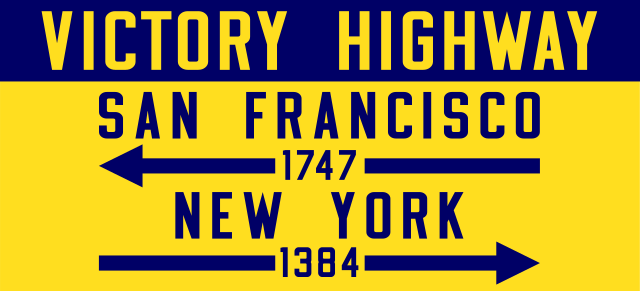
Photos: Victory Highway mileage shield (photo credit: Wikipedia) and part of the Victory Highway traveling exhibit at the Wyandotte County Historical Museum, Bonner Springs
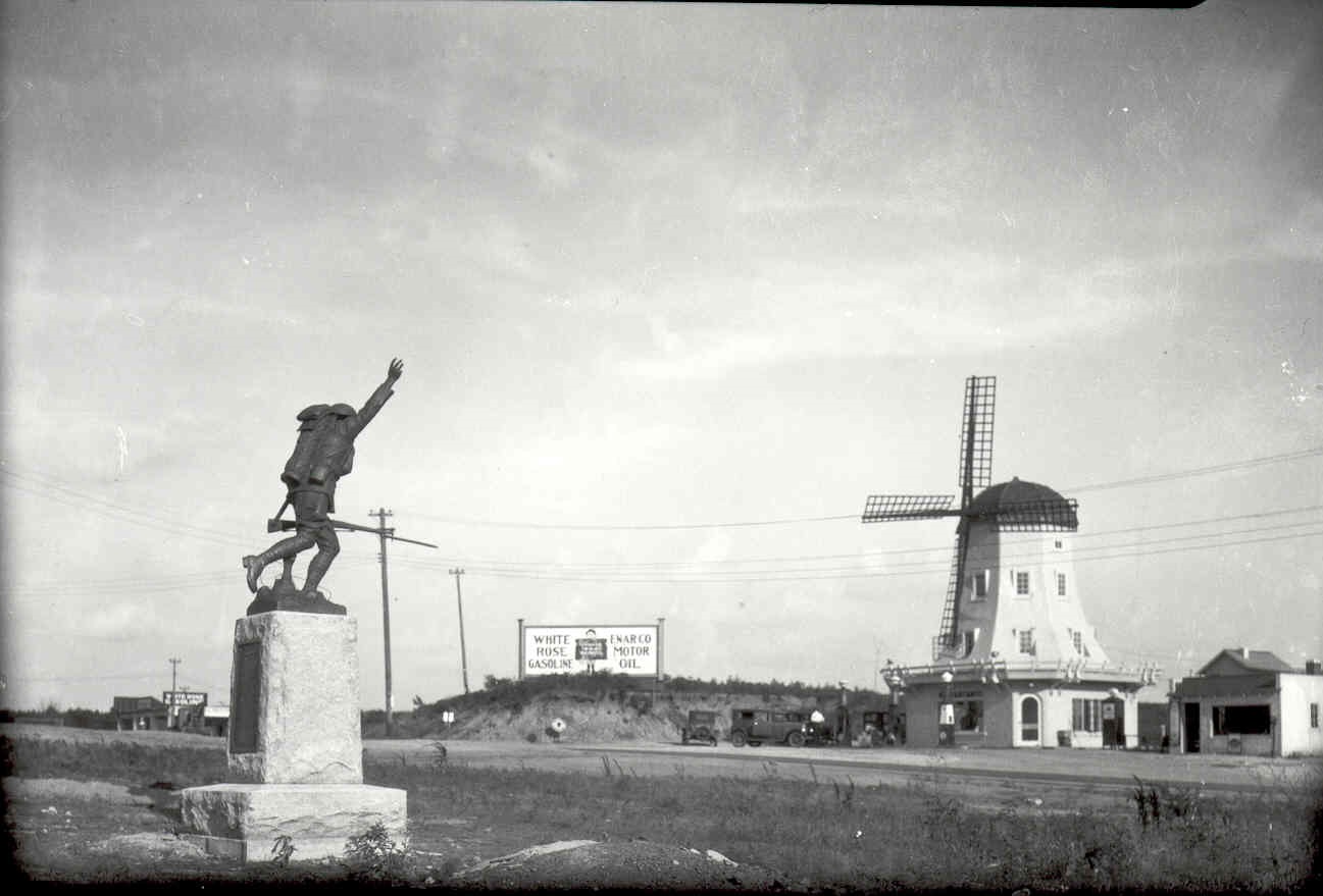
World War I Doughboy statue and Dutch windmill at Victory Junction in rural Wyandotte/Leavenworth counties...Victory Junction was located at the current corner of North 139th Street and Parallel Parkway
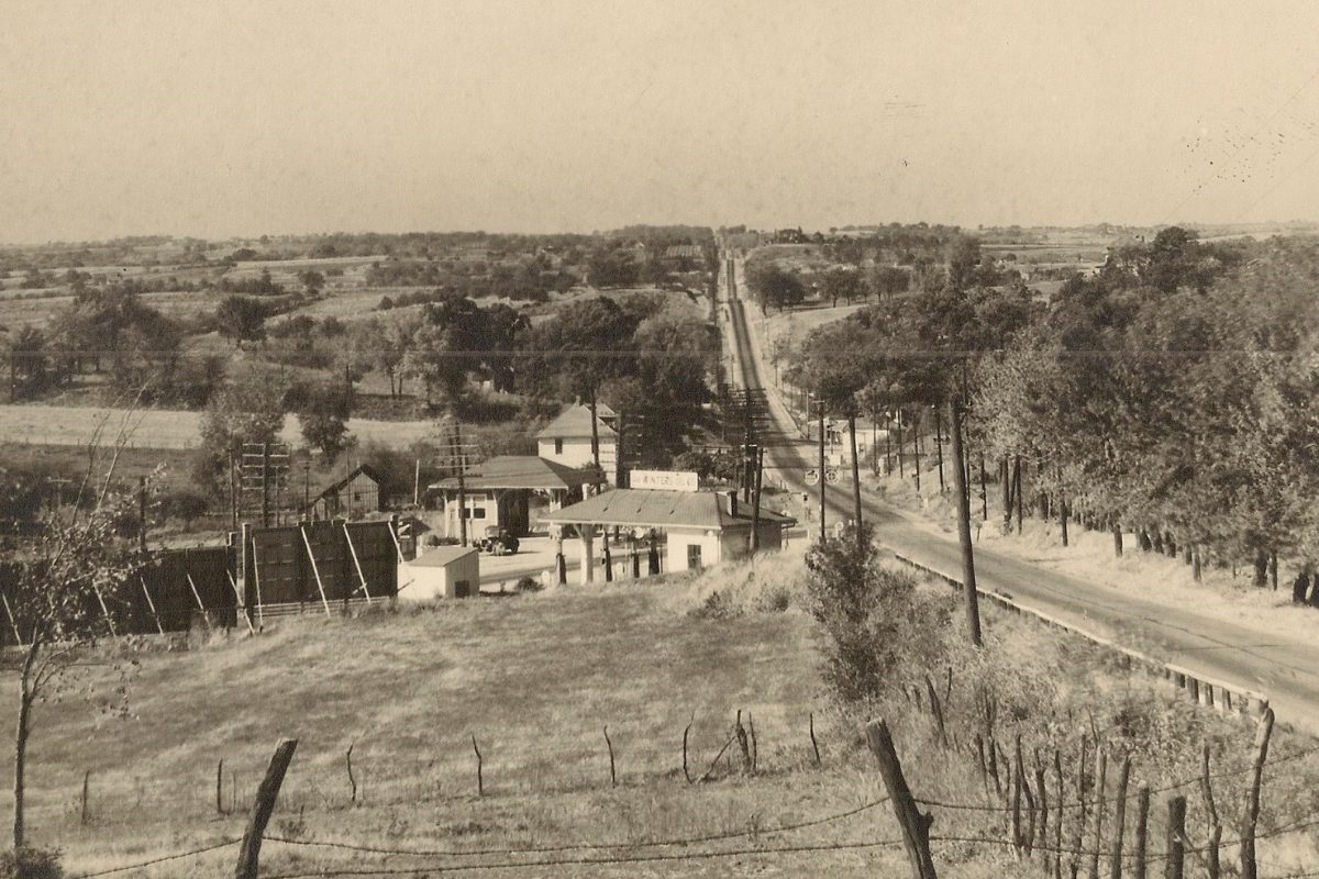
The intersection of Victory Drive and Parallel Avenue looking west during the 1920's, just west of KCK city limits...The first paved section of the Victory Highway ran from Topeka to Kansas City, Kansas and followed along Parallel in Wyandotte County...Victory Drive is one of the remnants of the original highway.
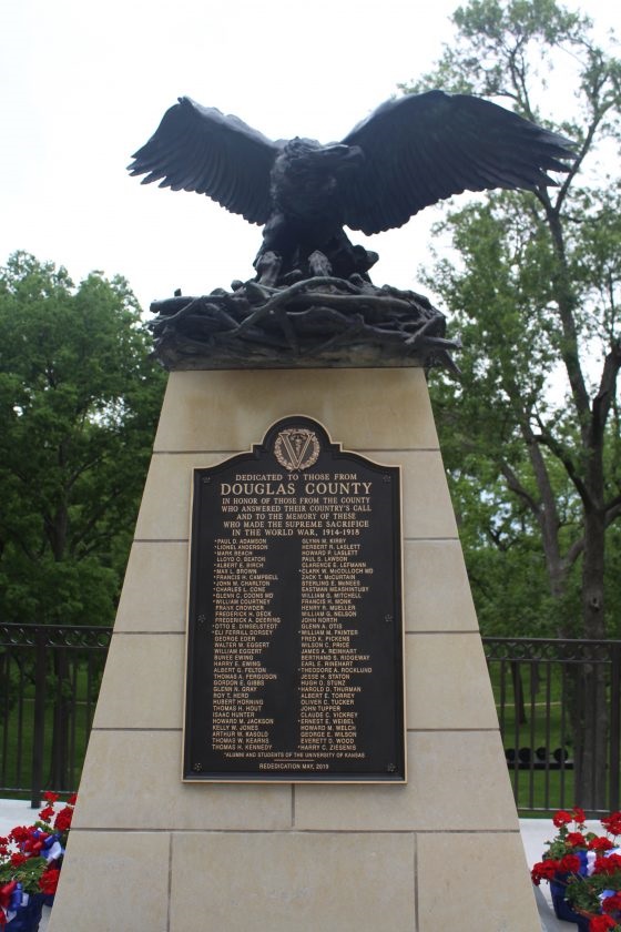
Victory Eagle on the University of Kansas campus, Lawrence/Photo Credit: Lawrence Journal-World